Thinking outside the box
December 19, 2011
Window shopping this weekend I noticed a trend in wall hangings: large, white cardboard cutouts of the Canadian provinces, especially the trio of Alberta, Saskatchewan and Manitoba.
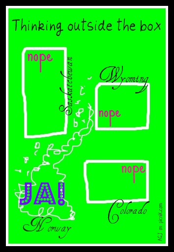
It got me thinking: if you only bought Saskatchewan, no one would know what the rectangle on your wall signified.
Cartography is a human invention, an act of civilization. That got me thinking even more.
Weather shapes human behaviour and self-expression. We often talk of southern cultures and northern, and expressly seek out the sun and warm breezes of southern climes to loosen up and relax.
But I often wonder how cartography shapes us. In other words, does how we chop up what nature has served up (mountains, lakes and plains) affect how we model our own realities?
Did the grid pattern of ancient land surveyors, for example, forever stamp the imagination of its settlers?
The midwest in Canada and the US is often criticized for being so straight-laced and fixed in its thinking, especially during political campaigns. Distance from port cities where there’s an easy exchange of ideas and goods can explain the midwest mindset, in part …
But does your overall shape affect your self-image too?
Imagine hailing from a box!
Nineteenth-century surveyors could have arbitrarily drawn a kink or two in Saskatchewan’s or Wyoming’s borders. But no. Straight arrows all. When there’s nothing in the landscape to go around, does that still the mind or numb the imagination?
And what of the countries or states that defy or were denied division by grid? Like Norway or the Netherlands.
Do craggy coastlines and cockeyed counties make for more squirrely inhabitants?


Leave a Reply